Swiss Regio: Meteo and Info
The program for the Swiss Regio:
- Meeting point Interlaken East railway station 8:45. You get your train AND cable-car ticket. If you are too late, you have to buy your own ticket!
- Departure 9:04 to Grindelwald (normal train to Grindelwald). If you arrive late, you can enter the train, we will be in the back of the train with the tickets.
- 10 Minutes walk to the First-Station
- Meeting point Grindelwald First valley station 09:50. Tickets Firstbahn to the Take Off will be handed out to those who do not yet have one
- Briefing directly at the launch site 11:15
- Take-off 12:00, Airstart 13:00
- 60 km flight, first landings maybe at Giswil or Interlaken
Meteo
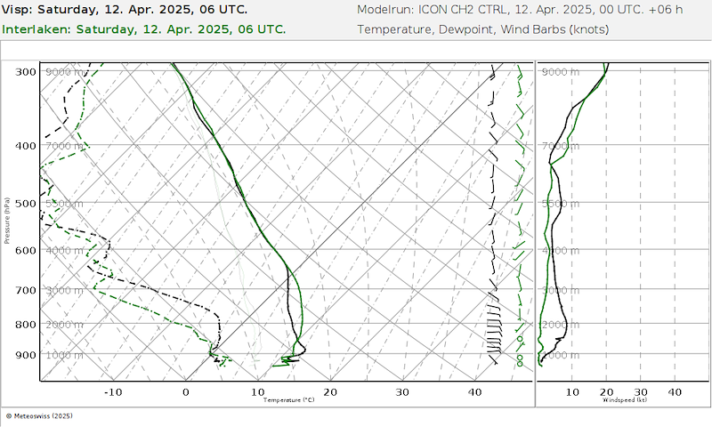
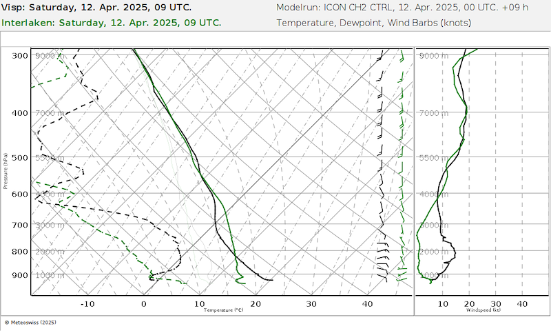
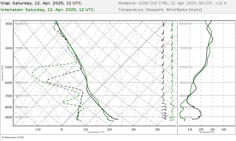
Heiter, ab Mittag Zirren, am Nachmittag aus Westen mittelhohe Wolkenfelder (es scheint immer noch, dass diese um 14 Uhr in Interlaken eintreffen, Sarnen eine Stunde später). Am späteren Nachmittag Niederschlag auf der Alpensüdseite.
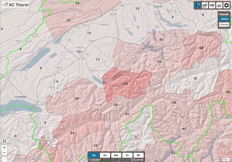
Die Modelle sind kongruent. Es fragt sich nur, wie stark die Zirren / mittelhohen Wolken sind. XC-Therm ist optimistisch.
Druckdifferenz steigt bis Mittag auf 5 hp, am Abend 6 hp. Die Windprognose hat in Bezug auf Föhn etwas zugenommen, Interlaken-Grindelwald-und der ganze Hardergrat sind aber gut geschützt.
Wind:
Boden schwach aus westlicher und nördlicher Richtung
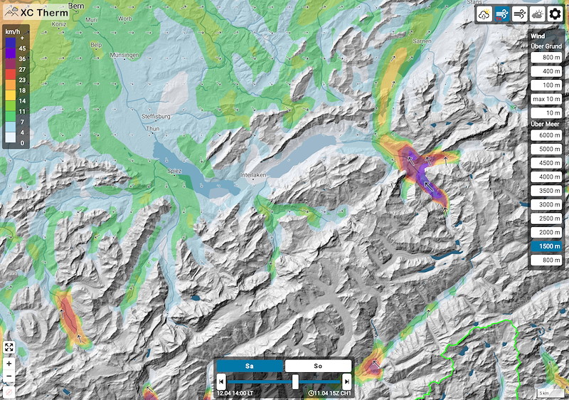
1500m schwach aus SW
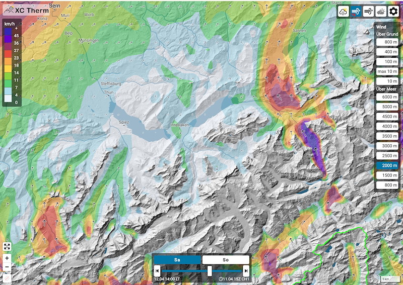
2000m in unserem Flugperimeter ebenfalls schwach, der Föhnkanal Haslital ist aber gut zu sehen!
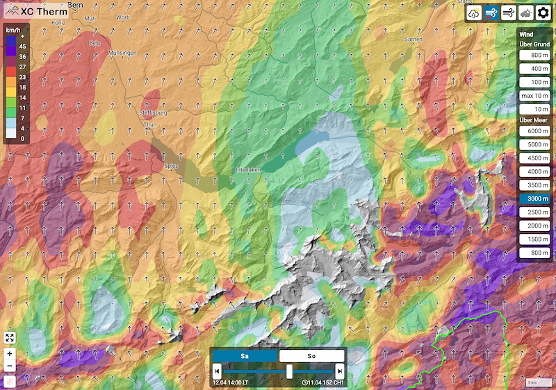
3000m westlich von Interlaken 10-20 S (je weiter westlich desto stärker), östlich schwächer, bis zum Haslital. Dort wieder stärker, 30kmh.
4000m ähnlich wie 3000m, aber etwas stärker.
**************************
Ciel dégagé, cirrus à partir de midi, l'après-midi champs de nuages d'altitude moyenne en provenance de l'ouest (il semble toujours qu'ils arrivent à Interlaken à 14h, Sarnen une heure plus tard). En fin d'après-midi, précipitations au sud des Alpes.
Les modèles sont congruents. La seule question est de savoir quelle sera l'intensité des cirrus / nuages d'altitude moyenne. XC-Therm est optimiste.
La différence de pression augmente jusqu'à 5 hp à midi, 6 hp le soir. Les prévisions de vent ont un peu augmenté en ce qui concerne le foehn, mais Interlaken-Grindelwald et tout le Hardergrat sont bien protégés.
Le vent :
Au sol, faible de l'ouest et du nord.
1500m faible du SW
2000m dans notre périmètre de vol également faible, mais le canal de foehn Haslital est bien visible !
3000m à l'ouest d'Interlaken 10-20 S (plus c'est à l'ouest, plus c'est fort), plus faible à l'est, jusqu'à Haslital. Là, à nouveau plus fort, 30kmh.
4000m similaire à 3000m, mais un peu plus fort.


New Comment