Swiss Cup Grindelwald: Takes place. Info and Meteo
Der Swiss Cup Grindelwald findet statt.
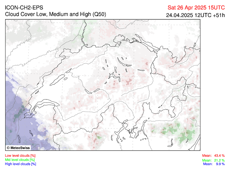
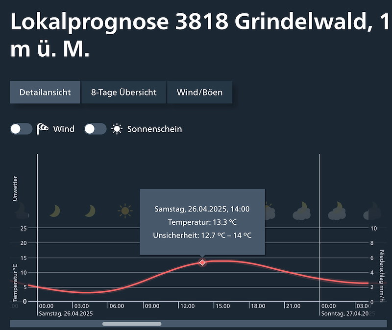
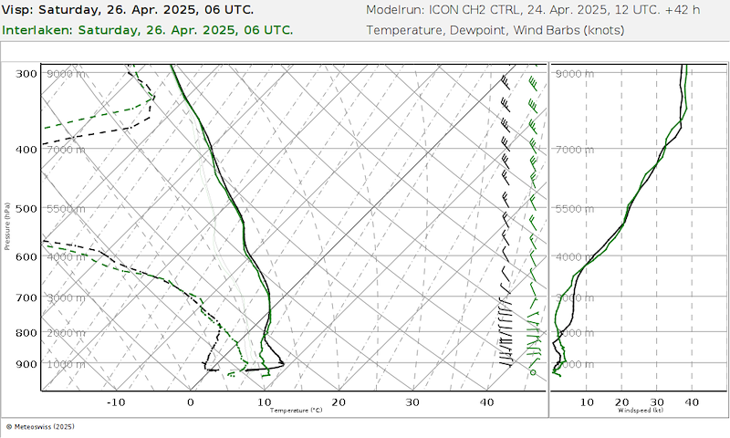
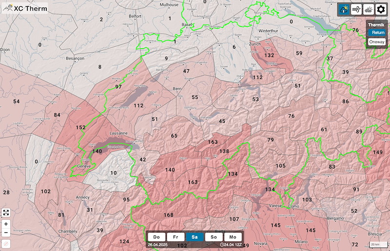
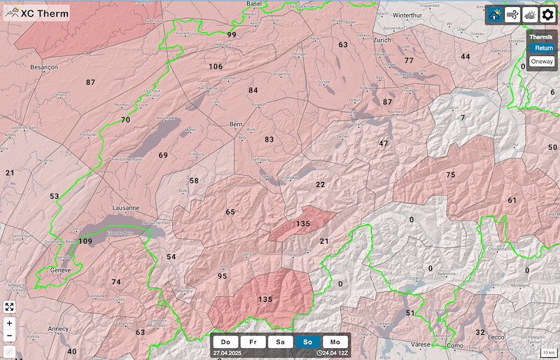
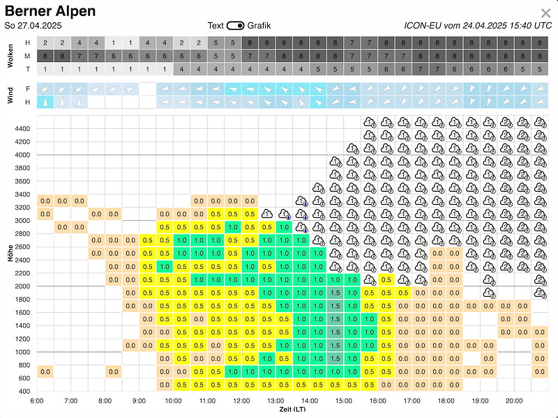
- Am Samstag rechnen wir mit langsamer Aufbau zu mässiger Thermik mit Top gegen 3000m. Am Nachmittag Bildung von 2-3/8 Quellwolken und sinkende Basis. Es ist also kein Super-Tag, wahrscheinlich können wir einen Task um 60km realisieren.
- Der Sonntag ist schwieriger. Ob es nochmals einen gültigen Task gibt ist unsicher. Wir werden am Samstag Vormittag entscheiden, ob wir den Sonntag ansagen oder nicht.
- Die Startgebühr beträgt CHF 70, egal ob der Cup ein oder zwei Tage angesagt wird. Ich werde am Freitag morgen die Rechnungen versenden.
Es gibt keine Selektion. Abmeldungen bis morgen Freitag, 10:00. Danach werde ich die Rechnung versenden, welche bis zur Einschreibung bezahlt werden muss.
********************************
The Swiss Cup Grindelwald will take place.
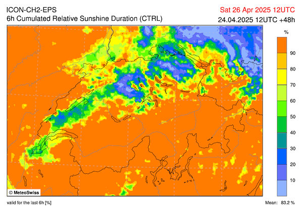
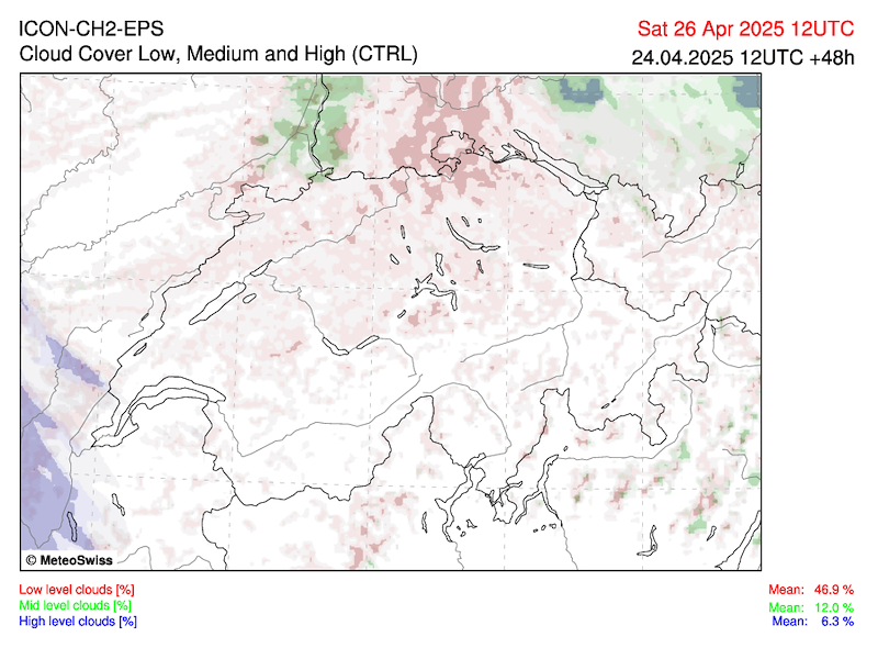
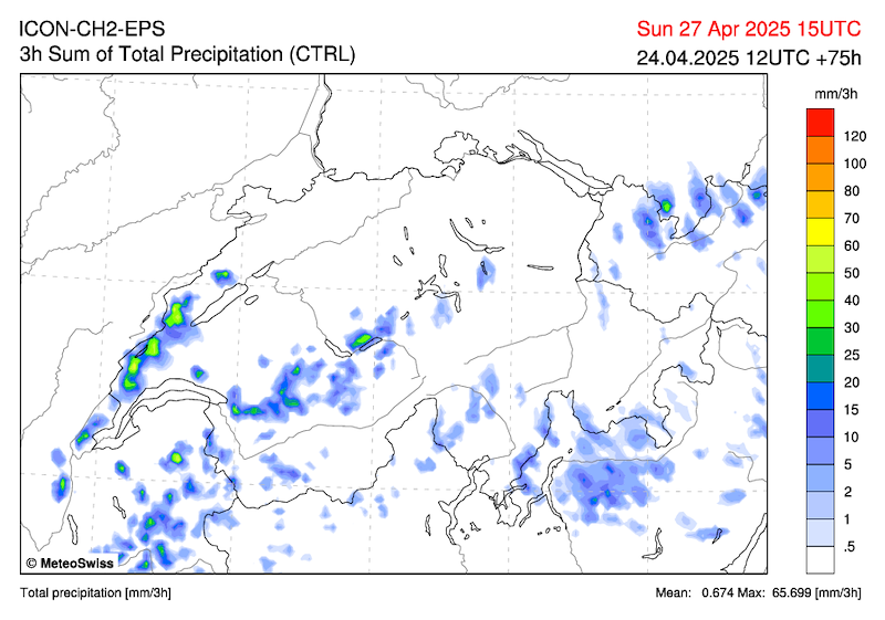
On Saturday, we expect slow build-up to moderate thermals with a top altitude of around 3000m. In the afternoon, 2-3/8 cumulus clouds will form and the base will sink. So it won't be a great day, but we will probably be able to complete a task of around 60km.
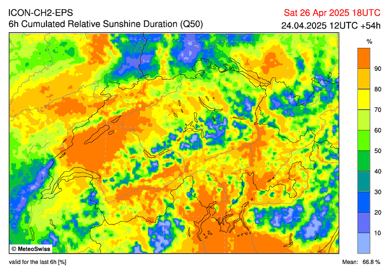
Sunday will be more difficult. It is uncertain whether there will be another valid task. We will decide on Saturday morning whether or not to announce Sunday.
The entry fee is CHF 70, regardless of whether the Cup is announced for one or two days. I will send out the invoices on Friday morning.
There is no selection process. Cancellations must be made by tomorrow, Friday, 10:00 a.m. After that, I will send out the invoices, which must be paid by before the registration on location.
METEO
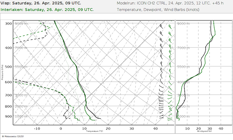
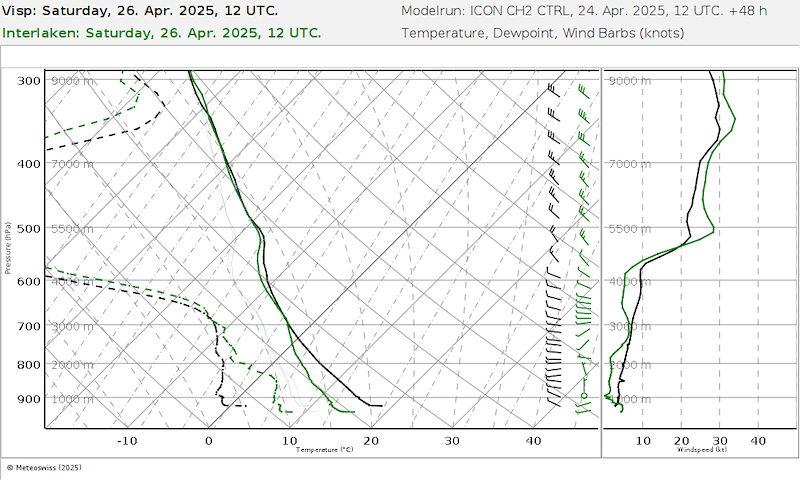
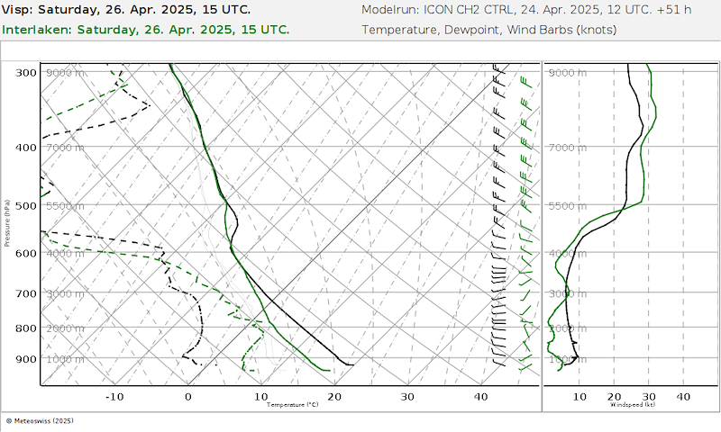
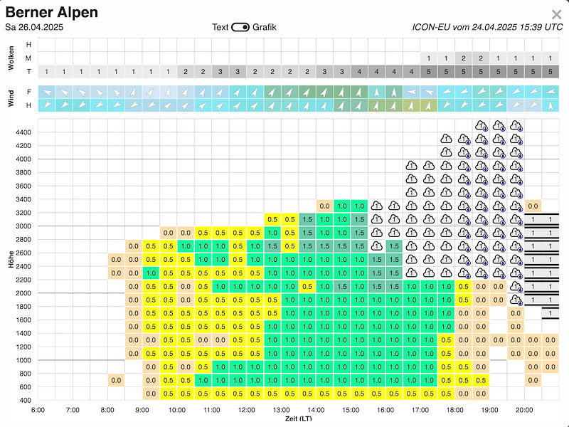
SAMSTAG
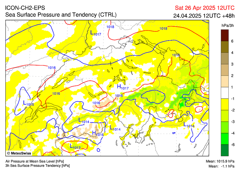
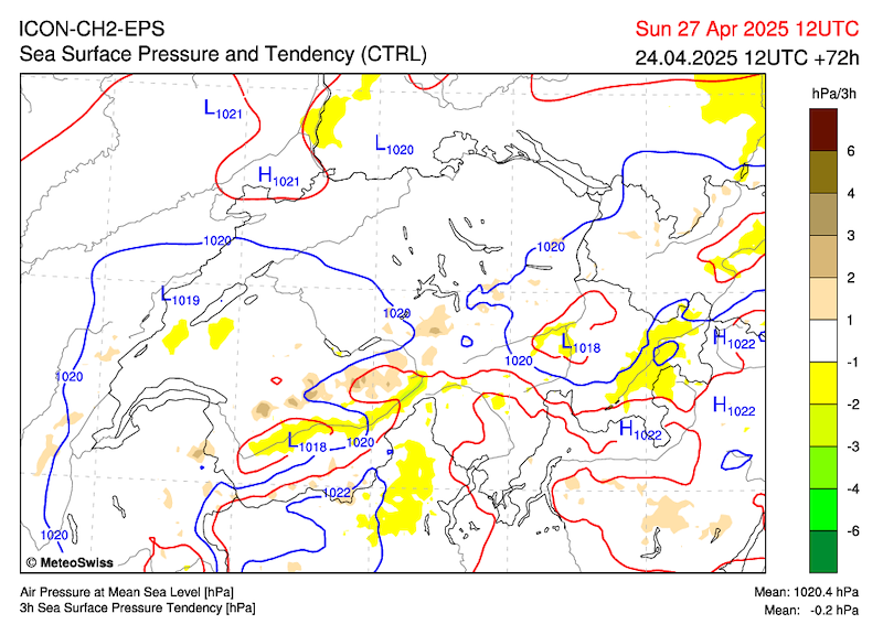
Auf der Alpennordseite am Vormittag wahrscheinlich noch ausgedehnte, hochnebelartige Wolkenfelder, sonst mit ausgedehnter Quellbewölkung teilweise sonnig. Inneralpin ziemlich sonnig. In den Bergen in der zweiten Tageshälfte einzelne Schauer nicht ganz ausgeschlossen. Höchsttemperatur mit Bise um 17 Grad. (MeteoSwiss). Abnehmender Nordüberdruck. Im Mittelland Bise und hochnebelartige Bewölkung (Obergrenze 1400-1500m).
Grindelwald
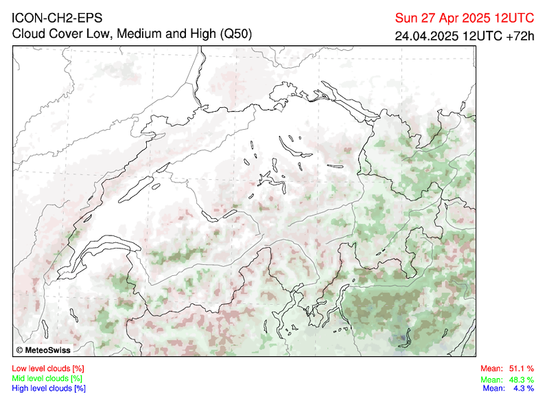
Langsamer Aufbau zu mässiger Thermik mit Top gegen 3000m. Am Nachmittag Bildung von 2-3/8 Quellwolken und sinkende Basis.
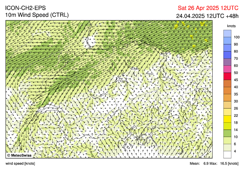
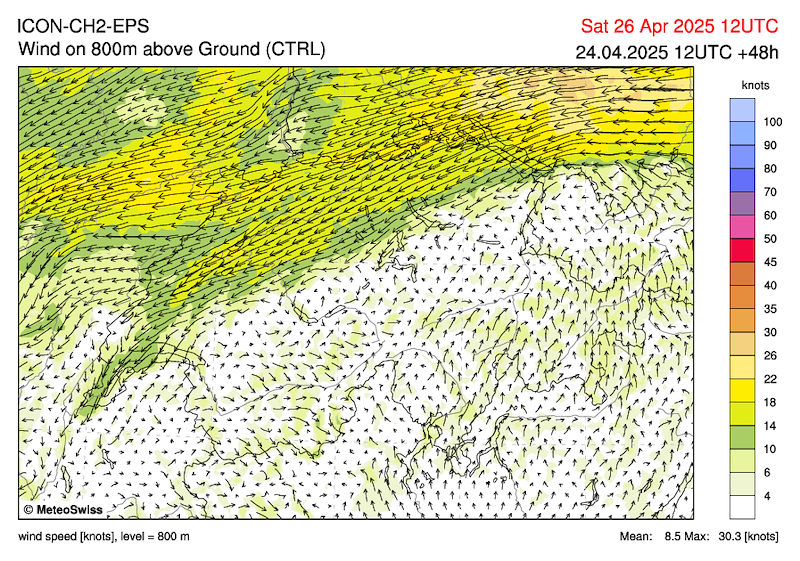
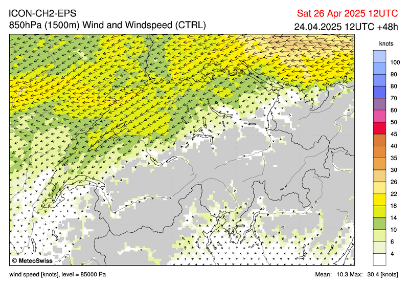
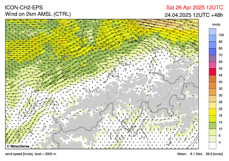
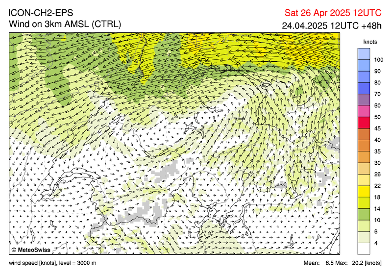
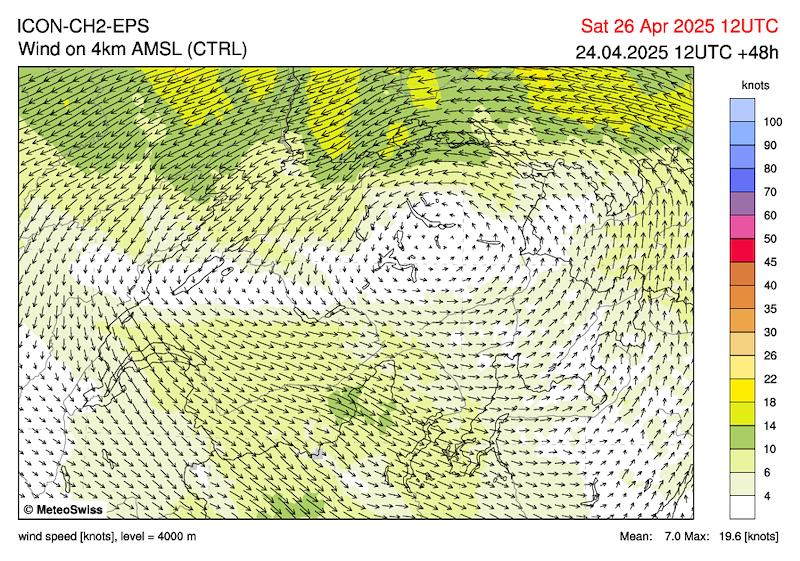
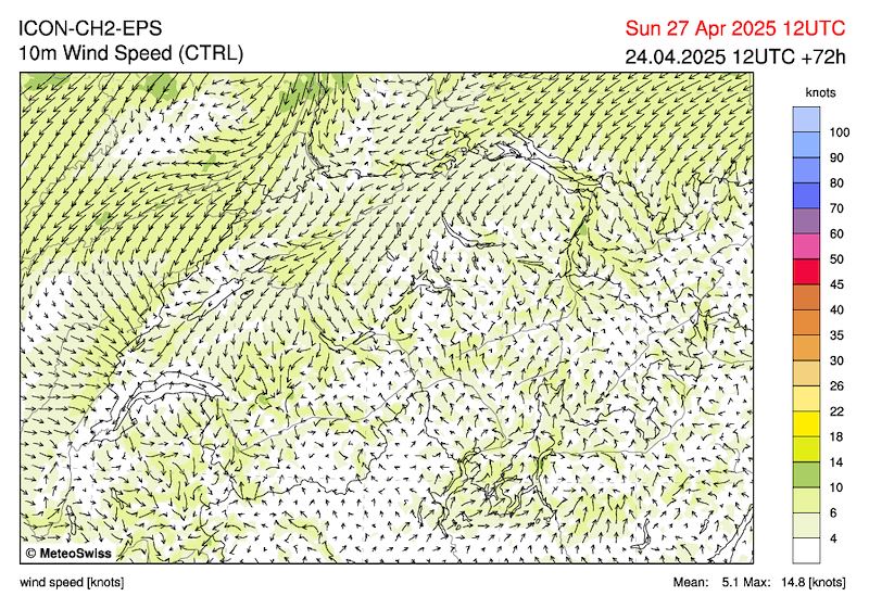
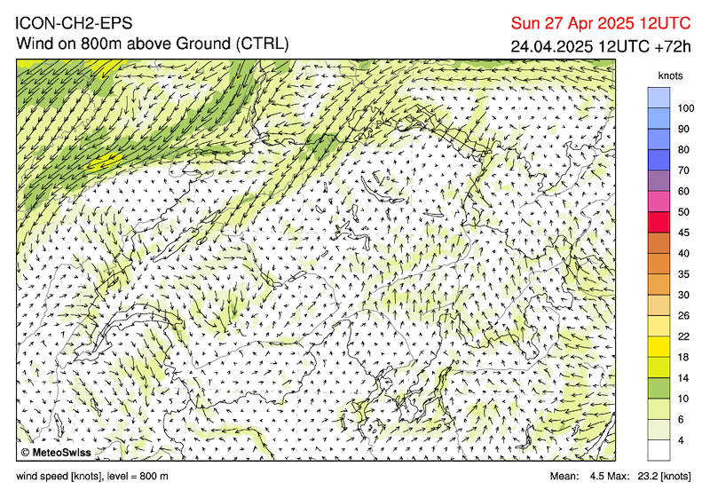
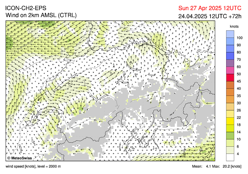
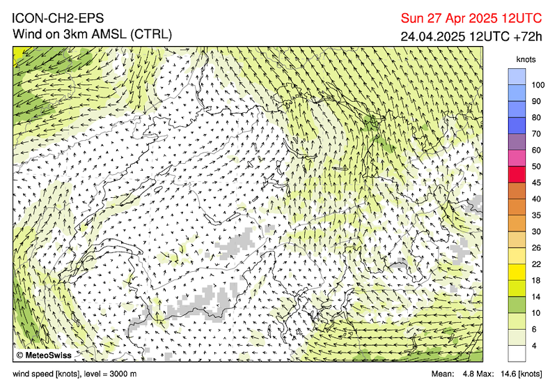
Mässige, wegen der Bise akzentuierte Talwinde, darüber schwachwindig. Auf 4000m 10 kmh W.
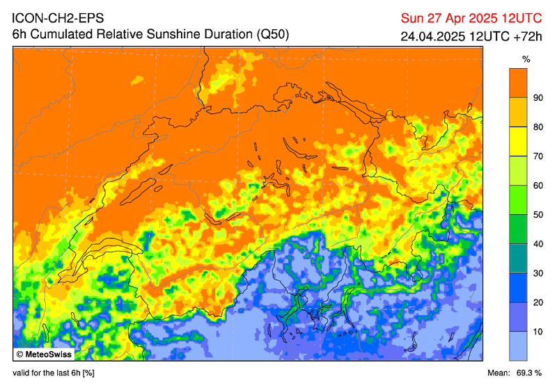
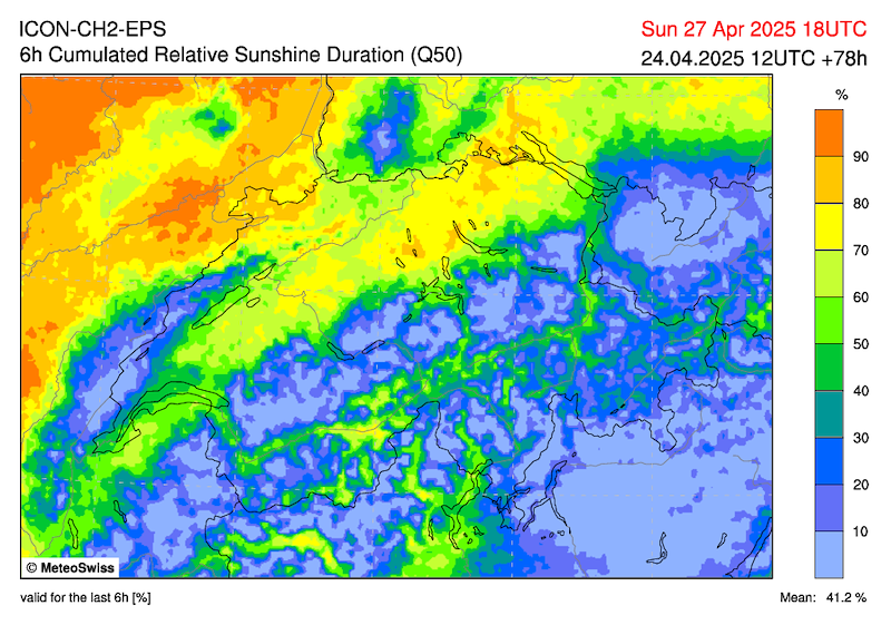
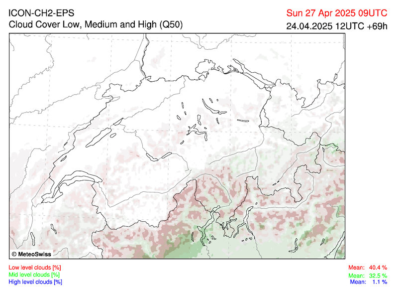
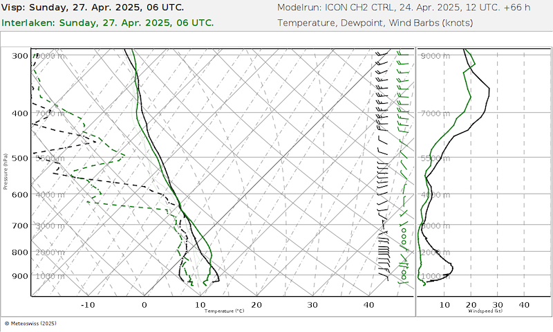
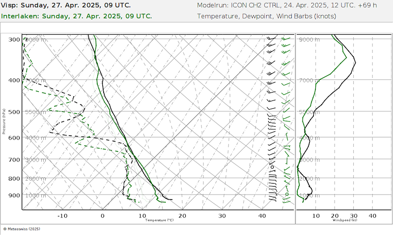
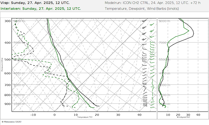
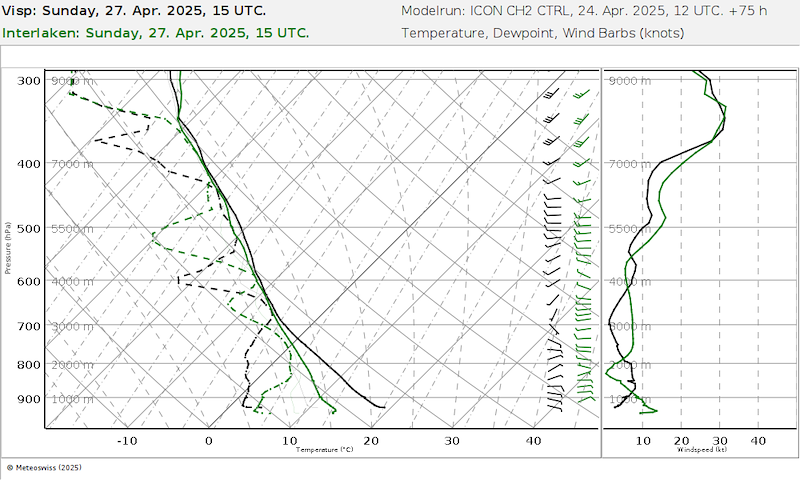
SONNTAG
Im Flachland sowie inneralpin trotz Wolkenfeldern zunächst wahrscheinlich noch recht sonnig, im Tagesverlauf Bewölkungszunahme. Am Alpennordhang veränderlich bewölkt. Am Nachmittag und Abend einzelne Schauer oder Gewitter, vor allem über den Bergen. Höchsttemperatur um 17 Grad. (MeteoSwiss), nachlassende Bise.
Grindelwald
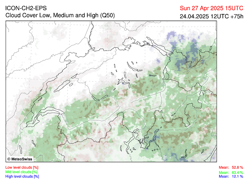
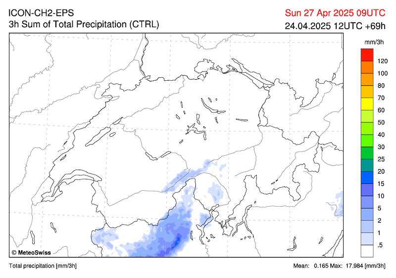
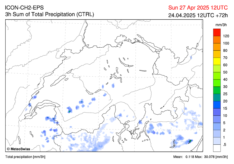
Samstag Nacht etwas Wind aus südöstlichen Richtungen, am Sonntag aber wieder wenig Wind. Von Nordost wird mit Höhenkaltluft feuchtere Luft an die Alpen geführt, am Alpennordhang am Nachmittag Schauer (Schauer möglich ab 14h, eher aber erst ab 15h).
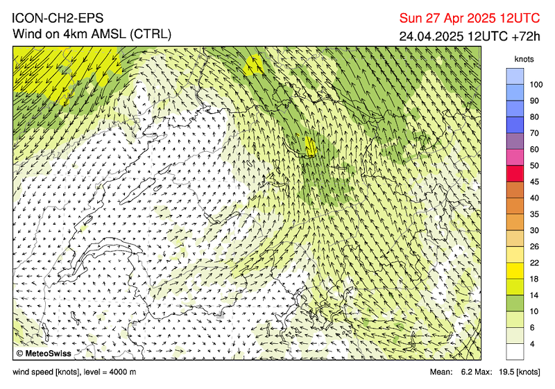
Mässige Talwinde, darüber schwachwindig. Auf 4000m 5 kmh SW.
Wiederum etwas Thermik, schwach-mässig, zunehmend Bewölkt, aber dank etwas S-Wind in der Höhe (je nach Modell SW bis SE) könnte es in Grindelwald lokal einigermassen schön sein. Ev. besser als der Wetterbericht, wobei die Feuchtigkeit mit dem Talwind von Norden herangeführt wird.
***************************
SATURDAY
On the northern side of the Alps, extensive high foggy cloud fields are likely in the morning, otherwise partly sunny with extensive cloud formation. Fairly sunny in the inner Alps. Isolated showers cannot be excluded in the mountains in the second half of the day. Maximum temperature around 17 degrees with a bise wind. (MeteoSwiss). Decreasing high pressure from the north. In the Swiss Plateau, bise and high foggy clouds (upper limit 1400-1500m).
Grindelwald
Slow build-up to moderate thermals with tops around 3000m. In the afternoon, formation of 2-3/8 cumulus clouds and sinking base.
Moderate valley winds accentuated by the bise, light winds above. At 4000m 10 km/h W.
SUNDAY
In the lowlands and inner Alps, it will probably remain quite sunny despite cloudy spells, with increasing cloud cover as the day progresses. Variable cloud cover on the northern slopes of the Alps. In the afternoon and evening, isolated showers or thunderstorms, especially over the mountains. Maximum temperature around 17 degrees. (MeteoSwiss), easing bise.
Grindelwald
Some wind from the southeast on Saturday night, but little wind again on Sunday. Moist air will be brought to the Alps from the northeast with cold air at higher altitudes, with showers on the northern slopes of the Alps in the afternoon (showers possible from 2 p.m., but more likely from 3 p.m.).
Moderate valley winds, light winds above. At 4000 m, 5 km/h SW.
Again some thermals, weak to moderate, increasing cloud cover, but thanks to some south wind at altitude (south-west to south-east depending on the model), it could be reasonably beautiful locally in Grindelwald. Possibly better than the weather forecast, although moisture will be brought in from the north by the valley wind.


New Comment