Preliminary information Swiss Cup Grindelwald
Die Modellunsicherheit ist vor allem für den Sonntag noch sehr gross. Wir müssen auf Morgen Abend warten, und hoffen, dass wir dann mehr Sicherheit haben.
Wenn ich heute entscheiden müsste, würde ich den Swiss Cup ansagen und hoffen, dass es am Sonntag (wie ich erwarte) besser ist als die Prognose.
Definitive Entscheidung morgen Donnerstag Abend.
METEO
SAMSTAG
Alpennordseite
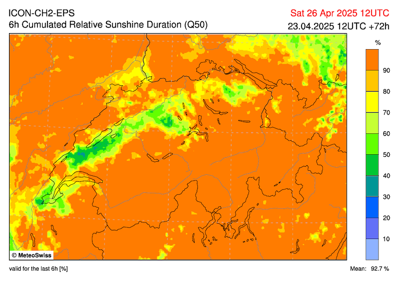
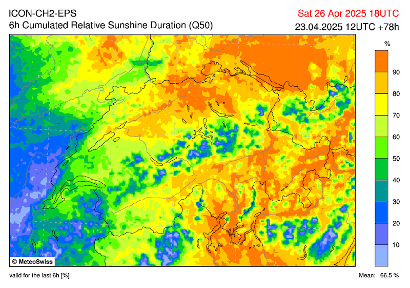
Auf der Alpennordseite am Vormittag noch ausgedehnte, hochnebelartige Wolkenfelder, sonst recht sonnig. Über den Bergen am Nachmittag Quellwolken und vereinzelte Schauer nicht ganz ausgeschlossen. Höchsttemperatur mit Bise um 17 Grad. (MS). Abnehmender Nordüberdruck. Im Mittelland Bise und hochnebelartige Wolkenfelder (Obergrenze 1500m).
Grindelwald
Langsamer Aufbau zu mässiger Thermik mit Top gegen 3000m. Am Nachmittag Bildung von Quellwolken und sinkende Basis.
Mässige, wegen der Bise etwas akzentuierte Talwinde, darüber schwachwindig.
SONNTAG
Alpennordseite
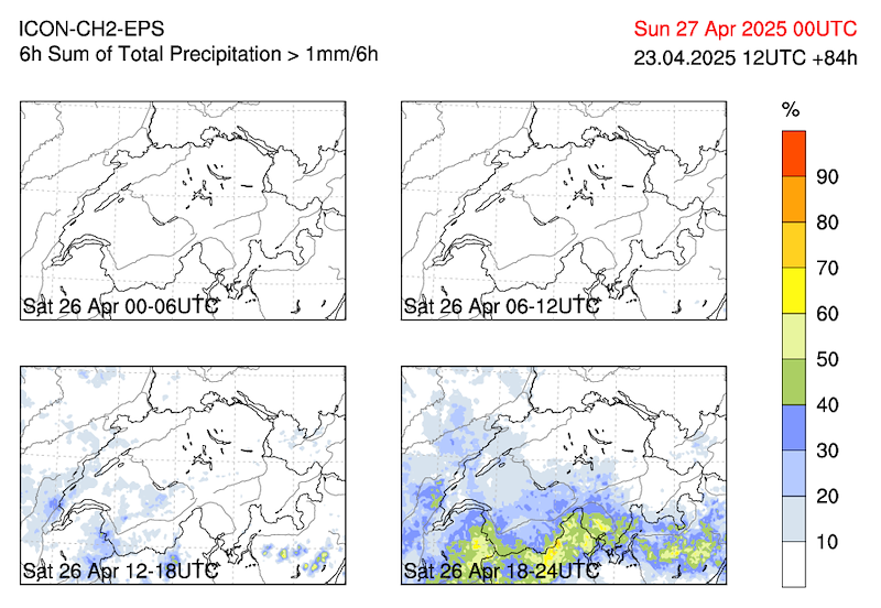
Wahrscheinlich bei veränderlicher Bewölkung zeitweise sonnig. Am Nachmittag und Abend einzelne Schauer oder Gewitter, vor allem über den Bergen. Höchsttemperatur um 18 Grad. (MS), nachlassende Bise.
Grindelwald
Samstag Nacht etwas Wind aus südöstlichen Richtungen, am Sonntag aber wieder wenig Wind. Von Nordost wird mit Höhenkaltluft feuchtere Luft an die Alpen geführt, am Alpennordhang am Nachmittag Schauer (grosse Unsicherheit, Schauer-Wahrscheinlichkeit 25%).
Wiederum etwas Thermik, schwach-mässig, zunehmend Bewölkt, aber dank S-Wind (je nach Modell SW bis SE) dürfte es in Grindelwald lokal einigermassen schön sein. Besser als der Wetterbericht.
*************************
The model uncertainty is still very high, especially for Sunday. We will have to wait until tomorrow evening and hope that we will have more clarity then.
If I had to decide today, I would announce the Swiss Cup and hope that it will be better on Sunday (as I expect) than the forecast.
The final decision will be made tomorrow evening.
METEO
SATURDAY
Northern side of the Alps
On the northern side of the Alps, extensive high fog-like cloud fields in the morning, otherwise quite sunny. Cumulus clouds and isolated showers not entirely ruled out over the mountains in the afternoon. Maximum temperature around 17 degrees with a bise wind. (MS). Decreasing north pressure. In the Mittelland, bise and high foggy clouds (upper limit 1500m).
Grindelwald
Slow build-up to moderate thermals with a top around 3000m. In the afternoon, cumulus clouds formed and the base dropped.
Moderate valley winds, slightly accentuated due to the bise, with light winds above.
SUNDAY
Northern Alps
Probably sunny at times with variable cloud cover. In the afternoon and evening, isolated showers or thunderstorms, especially over the mountains. Highest temperature around 18 degrees. (MS), easing bise.
Grindelwald
Saturday night with some wind from the south-east, but little wind again on Sunday. Moist air will be brought to the Alps from the Northeast with cold air at higher altitudes, with showers on the northern slopes of the Alps in the afternoon (high uncertainty, 25% chance of showers).
Again some thermals, weak to moderate, increasing cloud cover, but thanks to the south wind (southwest to southeast depending on the model), it should be reasonably nice locally in Grindelwald. Better than the weather forecast.


New Comment